
See
http://groups.yahoo.com/group/LexiLine/files/North%20America%20-%20USA%20Canada/
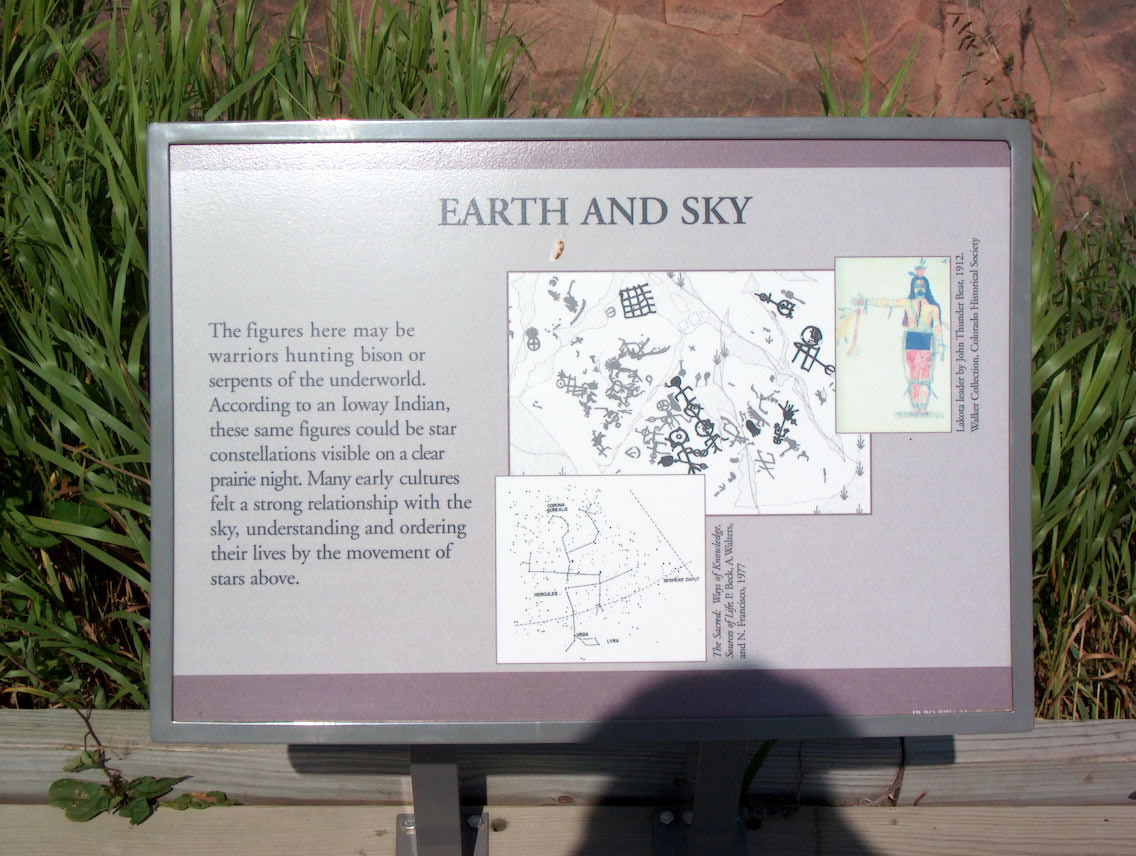
I had previously not been aware of the Jeffers Petroglyphs and herewith thank an anonyomous reader who recently alerted me to the existence of this large and highly interesting rock art site.
As you can see from the uploaded graphic, there is little doubt according to my analysis that the Jeffers Petroglyphs are an integral part of the land survey by astronomy of the Americas in prehistoric days.
As I have discovered, this site in Minnesota forms a Pythagorean isosceles triangle with the Miami Circle in Florida and with Altata (Culiacan) in Mexico where the measuring marker may have been the giant mound of El Umbligo near Guasave, although this is not certain.
Both the Miami Circle and Altata (Culiacan, El Umbligo near Guasave) are cardinal corner triangulation points on my previously published map of that ancient survey. See in this regard page 373 of my book, Stars Stones and Scholars http://www.trafford.com/Bookstore/BookDetail.aspx?BookId=SKU-000167707 and see also the map at megaliths.net
http://www.megaliths.net/northamericasurvey.htm).
When I write Pythagorean, I mean that the surveying angles used for triangulation by the ancients are those which result from the basic angles in a pentagon, see http://www.lexiline.com/lexiline/lexi205.htm
These angles for the Jeffers Petroglyphs in combination with the Miami Circle and Altata are 54 degrees at each lower corner for a total of 108 degrees and 72 degrees at the top for a total of 180 degrees. (Note that these are also the angles which were used to build the pyramids of Egypt, which surely also marked ancient geodetic survey by the stars.)
One side of that triangle is formed by a line that runs from Altata to Clovis, New Mexico,
http://archaeology.about.com/od/mesolithicarchaic/a/archaicwells.htm
the oldest of all known ancient US prehistoric sites, to the Jeffers Petroglyphs. Clovis is exactly half-way on that line. But this could be chance since nothing on that line can be regarded as a marker with certainty.
The other side of that triangle is formed by a line that runs from the Miami Circle through Cahokia, Illinois, the largest of all known ancient US prehistoric sites and runs to the Jeffers Petroglyphs. That is surely not chance since all of these are important ancient sites. See http://www.cahokiamounds.com/cahokia.html
For good measure, the 90 degree perpendicular from Altata runs through Cahokia directly to the Peterborough Petroglyphs in Canada, forming a 90 degree angle with the Jeffers Petroglyphs and the Miami Circle. Also that can not be chance.
In addition to that, the Peterborough Petroglyphs are at almost the same exact latitude as the Jeffers Petroglyphs, which in turn are exactly 15 degrees of longitude removed from the Miami Circle. And that, for certain, is not chance, but is an intentional measurement of 1/24h (one -twentyfourth) of the Earth's 360-degree circumference.
In order to interpret the Jeffers Petroglyphs completely I need a complete map of the site with petroglyphs in their resepctive locations, i.e. a map such as http://www.megaliths.net/peterborough.htm. However, I have no such map, so that if anyone comes across one in a book or publication, please let me know. Thank you.
I see regarding the Jeffers Petroglyphs that an Ioway has already suggested that the Jeffers Petroglpyhs represent the stars. But of course that interpretation is surely correct, tied in with the use of astronomy for land survey.
http://www.ajmiller.net/images/4thJuly2002/20020706-jeffers-petroglyphs/HPIM0038.JPGI am also working on an article about just who these ancient surveyors were, but that will take some time yet.


No comments:
Post a Comment